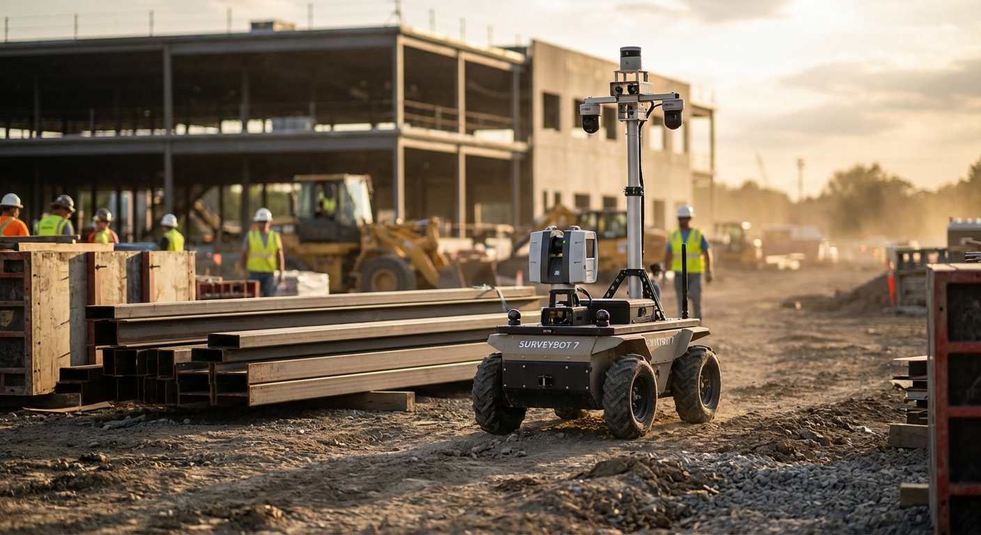
Construction Site Surveying
Capture precise topo data and track progress with mobile robots. LiDAR and RTK-GPS deliver BIM-ready accuracy under a centimeter to avoid rework and hit deadlines.
Why Automate Construction Site Surveying?
Enhanced Safety
Send bots to risky spots like unstable ground or hard-to-reach areas—keeping surveyors safe while grabbing key info.
Sub-Centimeter Accuracy
Industrial LiDAR/RTK beats hand surveys for precision, no drift.
Rapid Data Acquisition
Cover vast areas fast, no fatigue—speed up survey-to-insight cycles.
Real-Time BIM Updates
Push scans straight to BIM for instant digital twin checks.
Cost Reduction
Trim costs with smaller crews and no pricey fixes from bad data.
Consistent Repeatability
Repeat paths daily for exact change detection over time.
Workflow Integration
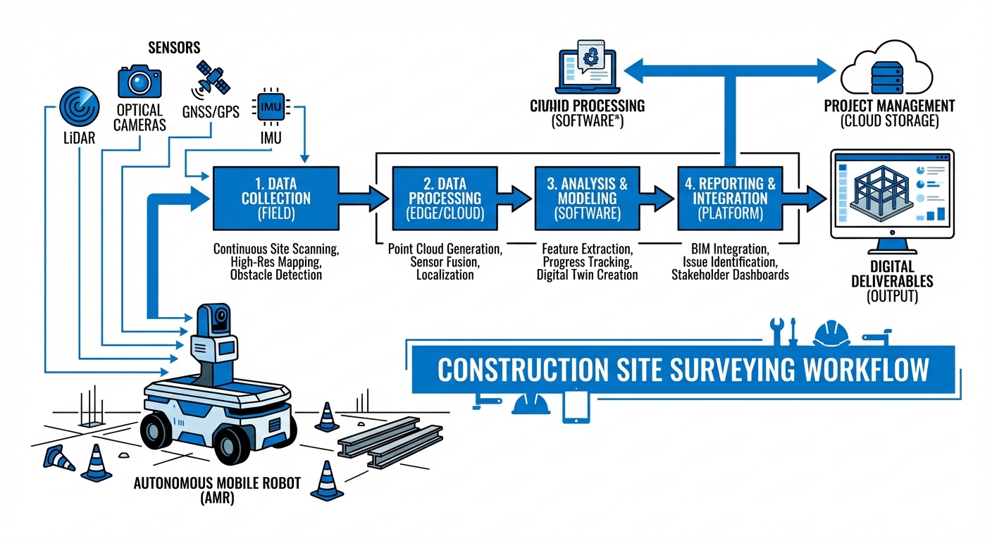
SLAM plus GNSS RTK for autonomous site nav. Set rough bounds in fleet software first.
LiDAR grabs millions of points per second for point clouds; cams add color and texture for 3D realism.
Upload to edge or cloud post-run. Algorithms clean noise from workers or machines, align to BIM, and flag issues fast.
Where It's Used
Commercial High-Rise
Floor flatness checks (FF/FL), column spots, MEP vs blueprints.
Civil Infrastructure
Long corridors for roads/bridges, earthwork volumes.
Mining & Excavation
Stockpile vols, slopes, tunnel shifts underground.
Industrial Plant Retrofitting
As-builts for upgrades, clash checks on new gear.
What You Need
| Component | Requirement |
|---|---|
| Robot Base | Rugged UGV or quadruped for gravel/debris. |
| Primary Sensor | 3D LiDAR (360° Field of View, min 100m range). |
| Localization | RTK-GPS Module for outdoor; Visual SLAM for indoor/GPS-denied areas. |
| Compute | Edge compute (Jetson AGX-like) for live point clouds. |
| Connectivity | 4G/5G or mesh Wi-Fi for data transfer. |
Frequently Asked Questions
How does the robot handle uneven terrain?
Tailored for rugged tracked robots or quadruped setups—like robot dogs—that tackle stairs, gravel, and obstacles up to 30cm high.
What is the accuracy of the scan data?
RTK-GPS delivers global accuracy of 1-2 cm. Point-to-point relative accuracy in the point cloud usually hits ±2mm, depending on your LiDAR model.
Does it work in the dark?
Absolutely. LiDAR's active light source lets the robot map in pitch-black conditions, tunnels, or dim basements.
Can it detect moving objects?
The navigation system spots moving objects to dodge collisions. Post-processing tools then scrub out any 'ghosts' from workers or equipment, leaving a crisp static map.
How long does the battery last?
Expect 2-4 hours of runtime based on payload and terrain. It handles autonomous docking and hot-swappable batteries for non-stop work.
Is it compatible with Autodesk Revit?
Definitely. Exports come in standard .LAS, .PLY, or .E57 formats, ready for Autodesk Revit, Navisworks, and other BIM tools.
Does it require internet connectivity?
It runs fully offline for data capture. You only need connectivity for live monitoring or cloud uploads—USB or LAN works fine for retrieval.
What happens if it rains?
IP55 or IP67 options handle light to moderate rain. Heavy downpours might fuzz LiDAR readings due to refraction, though.
How much training is needed to operate?
The interface is straightforward for non-experts. A site surveyor can master mission planning, deployment, and data pulls in under a day.
Can it replace human surveyors entirely?
It takes over the grunt work of data gathering, freeing surveyors for analysis, boundary checks, and tough calls.
Ready to implement Construction Site Surveying?
Scale up operations and shave time off projects with our autonomous tools.
Explore Our Robots